 |
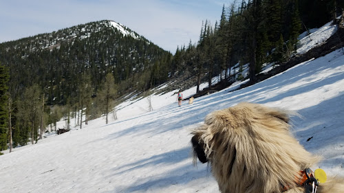
| Rhaenna watching Sara and Zeno head towards Poorman Mountain |
 |
| A bridge reminding us there is a trail somewhere under the snow |
The night before we ascended Poorman Mountain, we camped just below the confluence of the short Wolverine and Bluebird Creeks. These two creeks are the initial tributaries of the Wigwam River, which provided a gurgling soundtrack throughout the night. Initially I thought the Wigwam looked like a peaceful, snowmelt river, but after Rhaenna (our younger dog) got stuck in the river during a midnight exploration I was reminded that peaceful rivers often hide immense power, even only a few miles from their beginning. Rhaenna was okay, but shivered the rest of the night despite cuddling in a small tent with two people and a second dog. A loud thunderstorm probably didn't help her shaking either.
 |
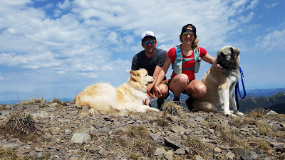
| Sara and Zeno near the summit of Poorman Mountain |
Much of the Montana portion of the Galton Range is encompassed by the Ten Lakes Scenic Area. Established as a Scenic Area in 1964, and additionally as a Wilderness Study Area in 1977, the Galtons have been able to re-establish a wild feel despite having lower slopes mined and logged in the first half of the 20th century. Only the occasional old road bed zig-zags through the higher slopes, and, as is the case near Poorman Mountain, the roads are merely used to access some of the 90 miles of trail maintained in Ten Lakes.
In the morning we drove up the highest of these roads until snow blocked our way. Fortunately we only had an extra half mile to the trail head so the blockage did not add on too much bonus mileage. The snow across the road was a harbinger of the rest of the day. Drifts visible on the trail immediately after the trail sign hinted at miles of exhausting postholing and cold feet. Fortunately though, the snow was firm and we stayed on top of the spotty drifts with ease. After a mile or so of mostly exposed trail, the dirt gave way to predominately snow.
 |
| On the top of Poorman Mountain |
Between two and three miles from the trailhead (it's hard to give exact mileage when we weren't positive we were above trail the whole time) we came across Wolverine Cabin next to a very frozen Wolverine Lake. The structure is an old Border Patrol cabin and is still maintained for visitors to the backcountry. Freshly chopped wood hinted at recent use, and I could see it being quite cozy in the middle of a snowstorm. Mid-summer though I think I would prefer to camp outside under the twinkle of stars and buzz of mosquitos.
Wolverine Lake revealed the glacial history of the range. Exposed cliffs carved by glacial sandpaper flanked the western shore and were a reminder that the peaks of Glacier National Park were still visible through gaps in the trees. It made me wonder why the glaciers in the National Park survived (at least this long) while those in the Galton and Whitefish ranges have not despite only being a few miles removed.
 |
| Heading down the East Ridge |
From the lakes we worked our way around an exposed scree field up to the pass between Green Mountain and Point 7886. In another month we would follow the trail along a similar path, but this day we were entirely on snow. The walking was still pretty easy since we could stay on top, and definitely easier than traversing the scree, but working north along the west side of Point 7886 I was wishing for the trail.
While we had spectacular views down to Lake Kookanusa, and a clean line of sight to the top of Poorman Mountain, the traverse was steep in the snow and we lost more elevation than necessary trying to stay on less steep terrain. Eventually though we gained the saddle and from there it was an easy ridge walk to the summit.
 |
| Beargrass Descent |
From the top we had excellent views of Glacier National Park, Waterton, and even the mountains around Fernie, BC. The Purcells were off in the distance, Lake Kookanusa (named for Kootenai, Canada, and USA - all three lands the lake covers), and the Tobacco Plains near Eureka lay before us. The Cabinet range we only caught glimpses of in between a thick cloud bank that reminded us that our time in the sun was likely limited.
After an enjoyable lunch in the lee of the wind, we began down the east ridge of Poorman Mountain hoping to make a loop by jumping on trail on an exposed south facing slope. Unfortunately the trail was still under snow so we ended up committing to a steep off-trail descent through beargrass and downfall to meet up with our tracks through Wolverine Basin. We used Kahtoola microspikes all day in the snow, but I think they were the most helpful in the beargrass!
The Galton Range is spectacular in the snow, but for ease of travel I highly recommend waiting until July for your visit. We are excited to go back and cruise the trails that we weren't able to enjoy.
NdisjuQmau-mu Anna Tran Download
ReplyDeletegnaramsivi